
My first understanding of Cahokia and pre-Columbian cities of the Americas came from the book 1491. Between 1050 and 1200 A.D., Cahokia was North America’s largest and most prominent cultural center north of Mexico. It wielded economic power and religious influence from the Great Lakes to the Gulf of Mexico. A new paper published in PNAS describes a possible mechanism for its collapse; flooding.
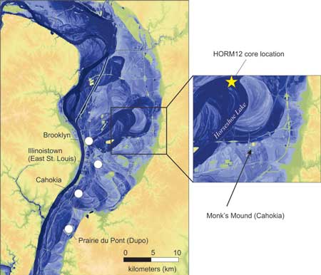
The authors stumbled upon this finding. They were extracting deep cores of sediments from two sites in the Mississippi River floodplain, nearby Cahokia’s former boundaries, each cross-section representing 1,800 years of geologic history. When examining these cores they noticed unusual layers with a fine and uniform texture, without pollen, charcoal or fossils… These sterile layers with typical of flood water sediments. It turns out these layers dated to the same time we saw the decline of Cahokia culture. Does that mean floods contributed to the downfall of this great city?

Reblogged this on Armstrong Archaeology and commented:
Students of next year’s Southeastern Archaeology class, discuss.
Look at that aerial representation: Why did the people settle on the east side of the river? > The flood zone. There must have been sizeable populations on the west side of the river that survived the collapse of their center (Cahokia). Perhaps, now weakened, fall into fragmented territorial/tribal disputes.